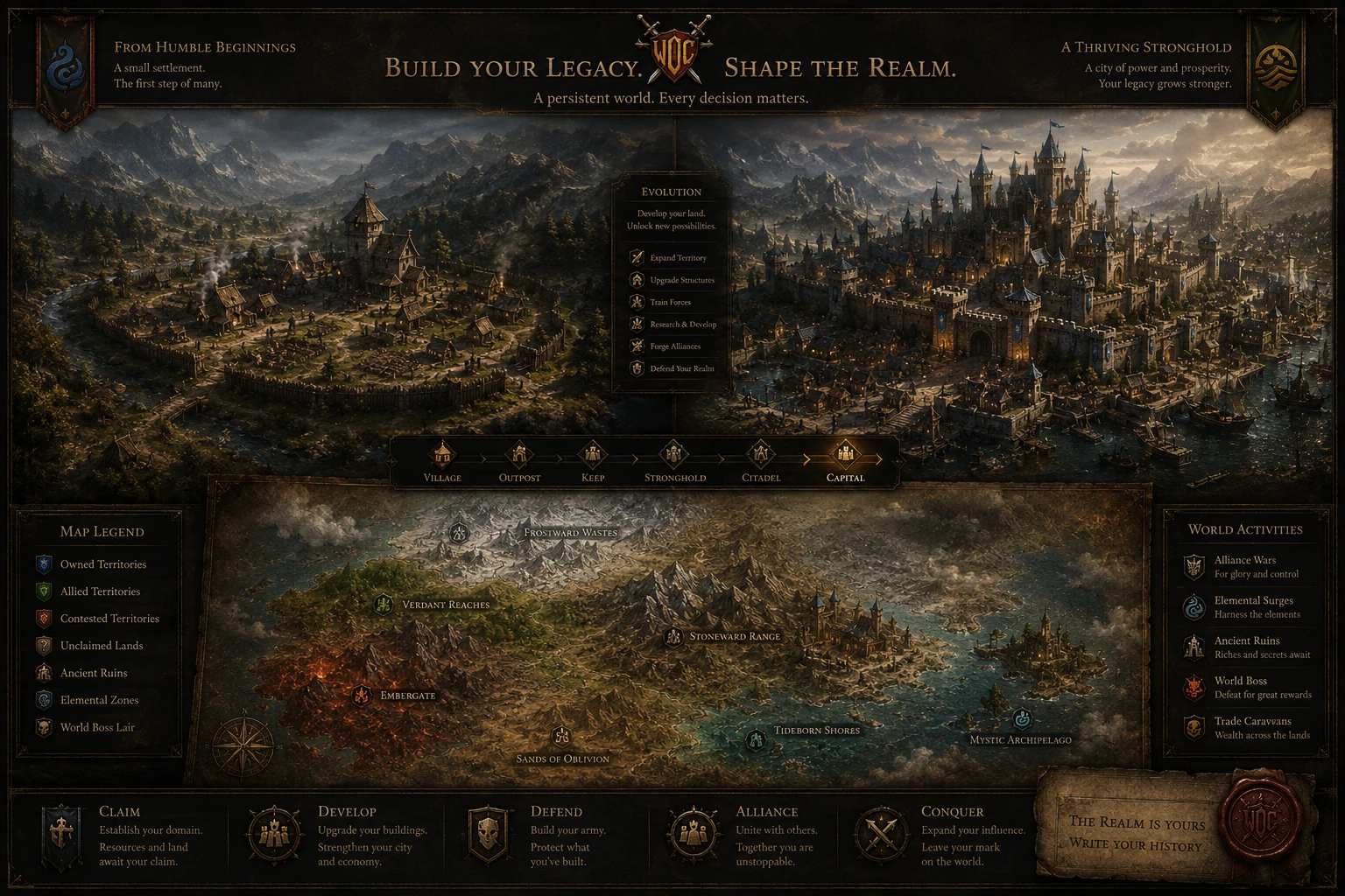
Establish a foothold
Begin with a place in the world, then turn fragile beginnings into a settlement with purpose.
A dark fantasy strategy world where settlements evolve, heroes travel, and every long campaign leaves a mark on the realm.
What players actually do
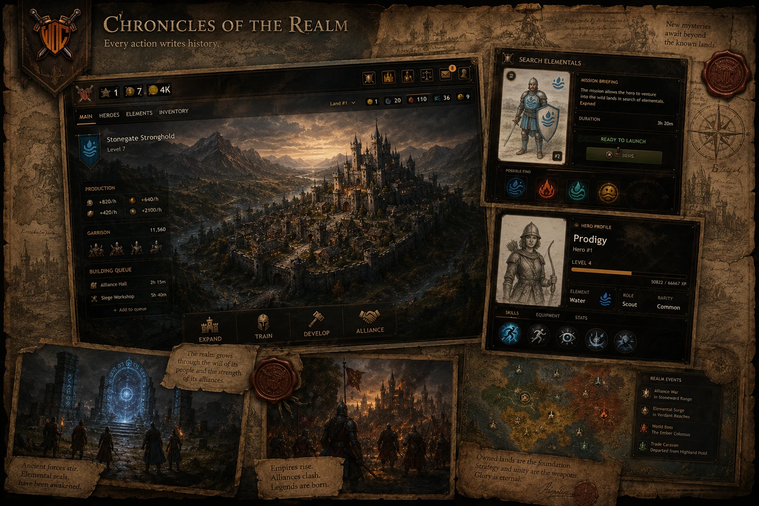
War of Continents is about long-term fantasy strategy: growing a settlement, developing heroes, reading the world, and choosing the next step with care.
Begin with a place in the world, then turn fragile beginnings into a settlement with purpose.
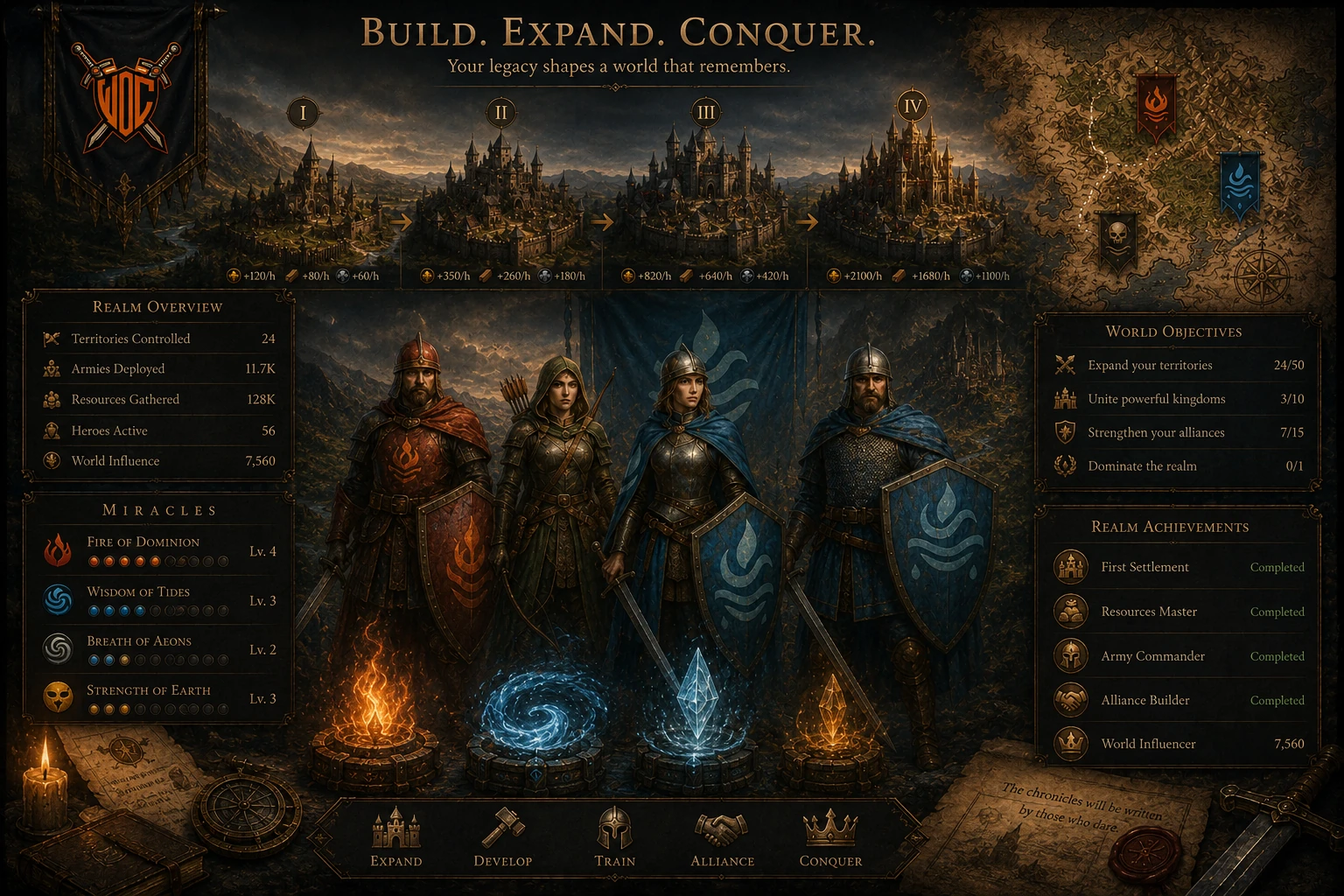
Make strategic choices around growth, resources, upgrades, heroes, and long-term priorities.
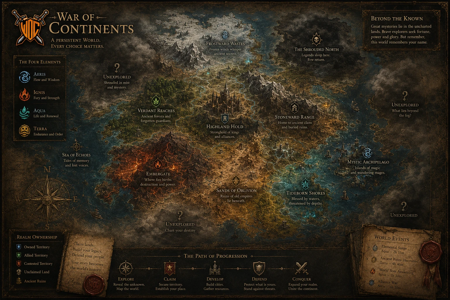
Follow missions and discoveries that reveal how the continents, elements, and heroes connect.
Progress through epochs, strengthen your domain, and leave a trace in a world that keeps moving.
Persistent world philosophy
The world is designed to feel like a place that grows around player effort. Progression is slower, more deliberate, and more satisfying when each choice has context.
Living ecosystem
The fantasy is strongest when the world feels connected. Growth, exploration, and discovery should reinforce each other instead of arriving as disconnected feature lists.
Small holdings become stronger domains as players invest attention and resources.
Heroes carry player intent into missions, discoveries, and the wider fate of the continents.
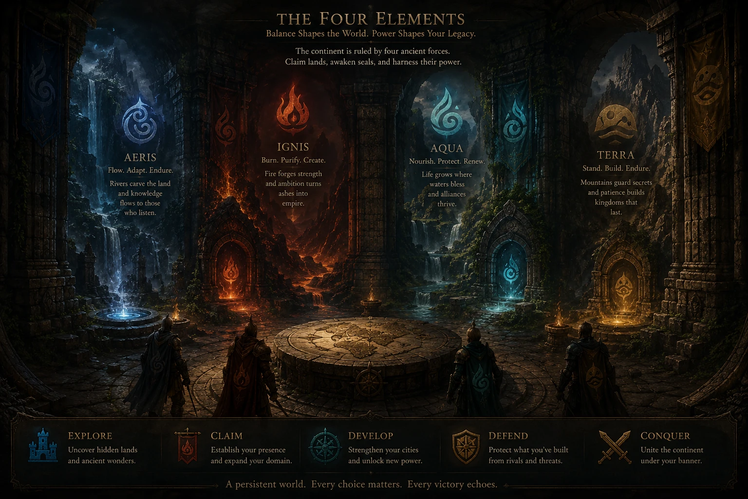
Elemental forces give the world texture, mystery, and a reason to keep exploring.
Visual world showcase
The new landing page leans on fantasy atmosphere first: cinematic, restrained, readable, and rooted in the world players are entering.
From a humble claim to a fortified stronghold, growth is the emotional center of the journey.
The map is not just scenery. It frames expansion, rivalry, routes, and long-range planning.
The living world is shaped by forces players learn to understand, gather, and master.
Epoch roadmap
Elemental Awakening is already live, and the War of Continents roadmap is built around future epochs that keep adding new content, progression, and conflict over time.
Ownership infrastructure
War of Continents keeps ownership visible but quiet. The landing page explains the infrastructure after the player understands the world, progression, and reason to care.
Selected lands, heroes, and items can exist as player-owned assets with clear provenance.
Ownership supports the fantasy strategy world. It is infrastructure beneath the experience.
Players can learn the ownership layer after they understand the world and progression loop.
Getting started
Onboarding should answer the first question quickly: where do I begin? Ownership and deeper mechanics can come after the player has a path.
Development philosophy
The project is strongest when every update adds to continuity: clearer onboarding, richer progression, stronger atmosphere, and a world players can imagine returning to.